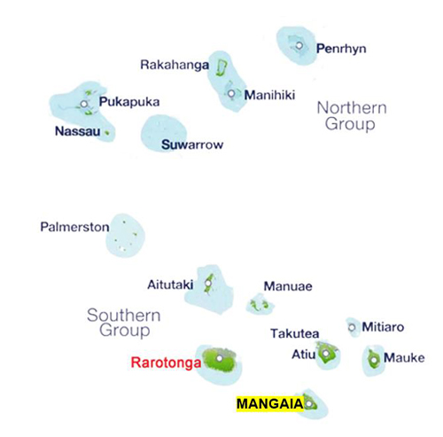

Internal airline, Air Rarotonga operates flights to and from Rarotonga on Monday, Wednesday and Friday. The trip takes about 40 minutes. And as the plane goes straight back, you need to stay at least two nights on the island...assuming you want to see more than just the airstrip!
SMALL BUT PERFECTLY FORMED
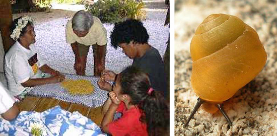
Mangaia is renowned for its shell neckbands or "eis". These are made from the shells of the tiny yellow snail, the pupu, which emerges only after rain. Gathering, piercing and stringing is a very time consuming business. The women of the island often give the highly prized strands away as gifts of friendship to visitors from other islands in the Group. But they are also much in demand in Tahiti and Hawaii
THE RARE BIRD WITH AN IDENTITY CRISIS?
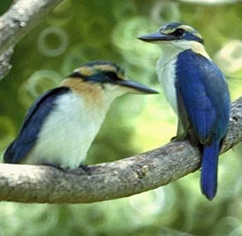
The Mangaia Kingfisher (Todiramphus ruficollaris) is found nowhere else in the world, and its name is totally misleading. It never eats fish! Like its distant cousin, the Australian kookaburra, it preys instead on skinks, insects and spiders. The colourful bird lives high up in the forest growing on the makatea. Birdlife International says there are between 400 and 700 birds on the island, but because they're unique to Mangaia, they're classified as an endangered species
Photo: Cook Islands Biodiversity Database, Gerald McCormack
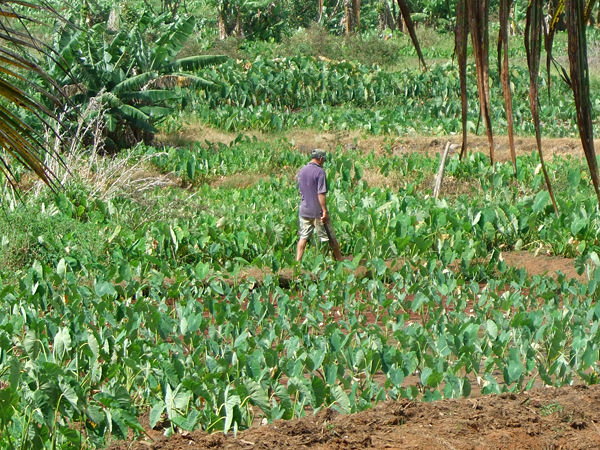
THE TROPICAL POTATO
Taro is sometimes called the "potato of the tropics" and the finest is said to grow on Mangaia. For those who are interested, it's high in vitamins A and C, has only a trace of fat and is particularly good for anyone with digestive problems or food allergies. As you can see from the photo, lush taro plantations and other vegetation thrive in the centre of the island at the bottom of the makatea, and in the central valley. But, much as I love the Islands, I have to say taro is an acquired taste!
"SYDNEY HARBOUR BRIDGE OF MANGAIA"
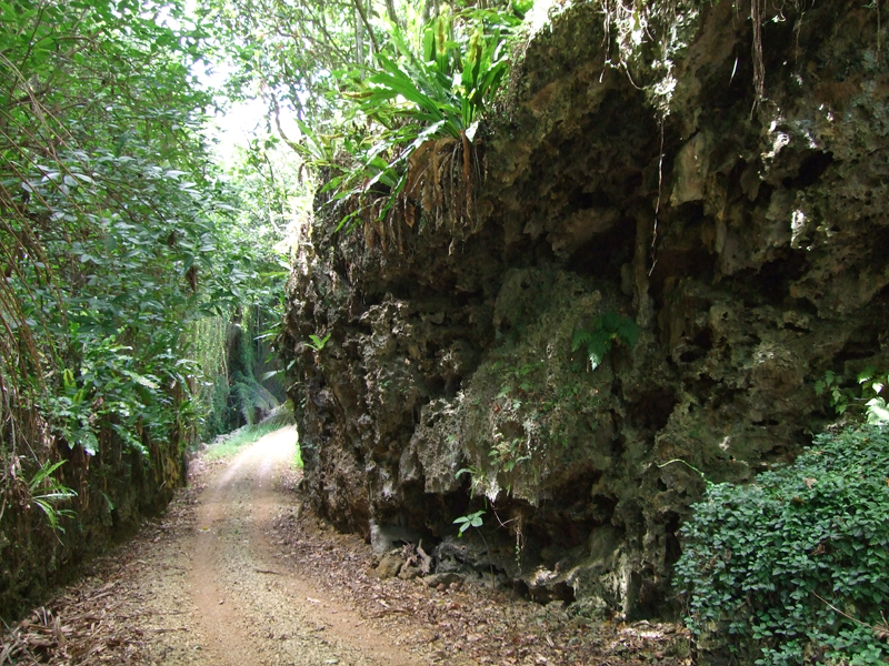
The road in the picture is near Tava'enga village and it was blasted through the makatea in 1951 using war surplus explosives. It was an amazing engineering feat. Before it, bulky goods were carried on horseback up a series of steps. Ewan Smith, MD of Air Rarotonga compares it in his coffee table book, 'The Cook Islands' to Sydney Harbour Bridge for the way it transformed travel on the island. I'm no engineer, but I marvelled at the achievement

Accommodation is very limited. Babe's Place is a traditonal Polynesian guest house in the main village of Oneroa complete with wifi! There's also Ara Moana Bungalows (pictured) which nestle in a tranquil setting among the puka trees near the village of Ivirua. They're very small and basic but very clean and peaceful
TOP TIP: The number one "must have" for any visitor is a strong pair of walking shoes. The fossilised coral, or makatea looks like a field of colourful flowers from a distance, but closer up you can see it makes for very rough walking. And with almost no proper roads, my feet were sore for days after wandering around the island. But don't be deterred from venturing out...you'll meet some very friendly locals (both human and animal!) and enjoy uniquely ancient scenery
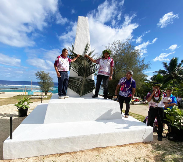
This is one of three monuments unveiled as part of celebrations in June, 2024 to mark 200 years since the arrival of Christianity on the island. It's down by the harbour in Oneroa on the site where the first missionaries landed in 1824. The three faces represent the Aronga Mana (the leaders of Mangaia), the Religious Advisory Council (the body that governs the spiritual development of the island) and the Cook Islands Government. The two other monuments are at Marae o Rongo, Akaoro and the Hospital Photo: Cook Islands News
Sandy beaches are few and far between. Below ground though, there's a whole different world to explore. Mangaia is honeycombed with amazing caves like the one pictured centre with its owner, Teremanuia Taukakuma. And inside, there are stunning natural rock formations. In pre-Christian times, many of the cave systems on Mangaia were used as a refuge for those defeated in battle or designated as burial caves
Long before today's ubiquitous coffee shops, Mangaia had the first in the world...but they were called tī-houses! And now a tradition that began in the 19th century is back. T's Coffee has opened in Oneroa. Apparently Mangaians had only one word for any kind of hot drink hence the name. The tī-house coffee was grown and processed locally. It was called kāōpe on the tree and didn’t become tī until it was brewed from the tree's roots like those you can see here
The shops were cooperatives set up set up as a form of indigenous resistance to the growing number of European trading stores on Managaia which islanders felt were ripping them off. Back in those days the coffee was decanted into real china bowls from China and just like today's coffee shops, the tī-houses were also a place to meet up and share the latest news and gossip
Source: Rod Dixon writing in Cook Islands News
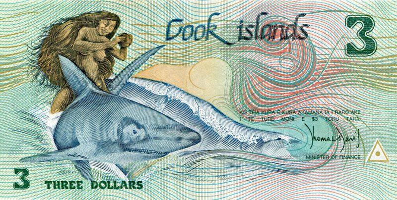
The $3 note is a unique souvenir of the Cook Islands and it ilustrates the tale of a young woman riding a shark which is told in song on Mangaia. This is one version of that story:
There was a god of the Ocean called Tinirau who lived on a floating island called Motu-Tpau. Ina was his beloved and she plunged into the sea to search for him. She first called on the fish to help her. They were too small and she was tipped into the shallow lagoon. Then a sea-going shark agreed to carry her on his back.On the journey she felt thirsty and the shark raised his dorsal fin so that she could crack her first coconut. This she did and satisfied her thirst. Again she grew thirsty and this time, as depicted in the design on the note, she cracked the coconut on the shark’s head.At once the shark shook her off and dived and she was only rescued when Tekea the Great, the king of all sharks, rose from the depths, drove off the other sharks, and took her to Tinirau’s island. However the blow she gave to her first benefactor raised a bump on the shark’s head and to this day that is called Ina’s bump.

Click here for stunnning photos and the story of a total eclipse of the sun over Mangaia